thelandofmaps:

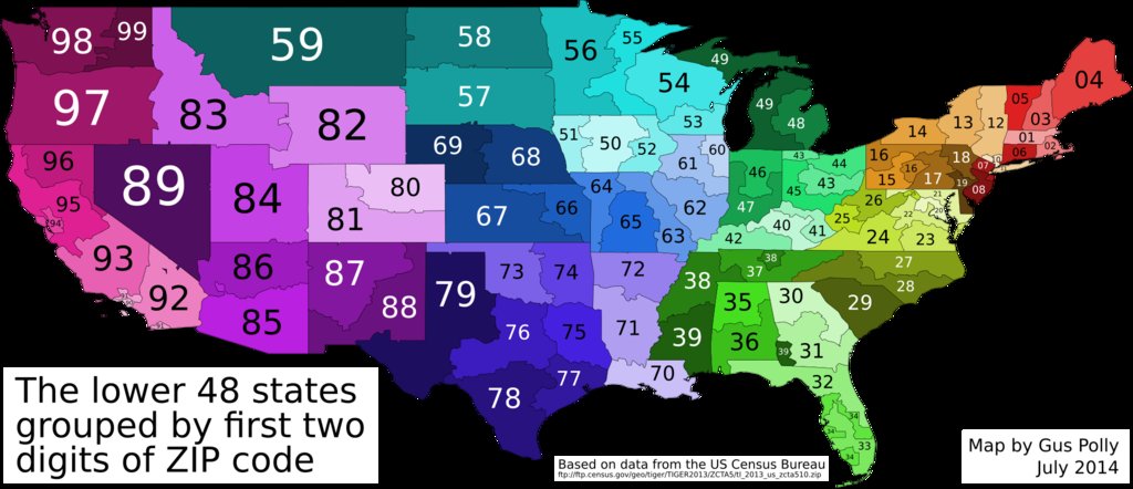
[OC] The US grouped by first two ZIP code digits [1920×828]
CLICK HERE FOR MORE MAPS!
thelandofmaps.tumblr.com

In case you were wondering, Hawaii is part of 96, Alaska is part of 99, and Puerto Rico is part of 00.


Tags:

#why don’t I have an America tag #I’m certain I’ve reblogged stuff about America before #oh well I can start now #maybe retroactively tag stuff later #should probably be something to go with my Canada tag #I guess that would make it #home of the brave #(which sounds a little less complimentary when you consider what a total coward I am) #(and how I often wonder why people don’t show a little more self-preservation) #anyway I always kind of wondered about this when I was a kid living in 08 #the more you know #tag rambles
epsilongrif:

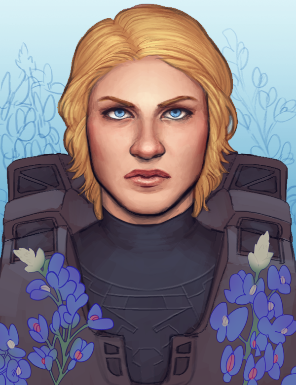
my entire life i have been under the impression that picking bluebonnets in texas is illegal and i just found out that’s only a myth. who the fuck lies to a six year old about picking flowers

and did you know that new york’s state flower is the rose? that’s bullshit. that is bullshit. blatant new york favoritism. roses don’t even grow in new york. nothing grows in new york except buildings and pizza. new york’s state flower should be a fucking taxi. i’m trying to give you a hint that i’m about to draw york covered in roses is it working


Tags:

#Red vs Blue #anything that makes me laugh this much deserves a reblog #there’s more to New York than the city #most of the state was only good enough to name once #I’m sure there must be roses in there somewhere #still hilarious though #(Red vs Blue progress: have finished 6×08) #(everyone (mostly Rose several times over) who told me that S6 was much better than S1-5 has thus far been totally right) #(apparently the big yelling-at-the-screen moment is near or possibly at the *end* of S6) #(I’m…looking forward? to it?) #fanart

bbcbaker:

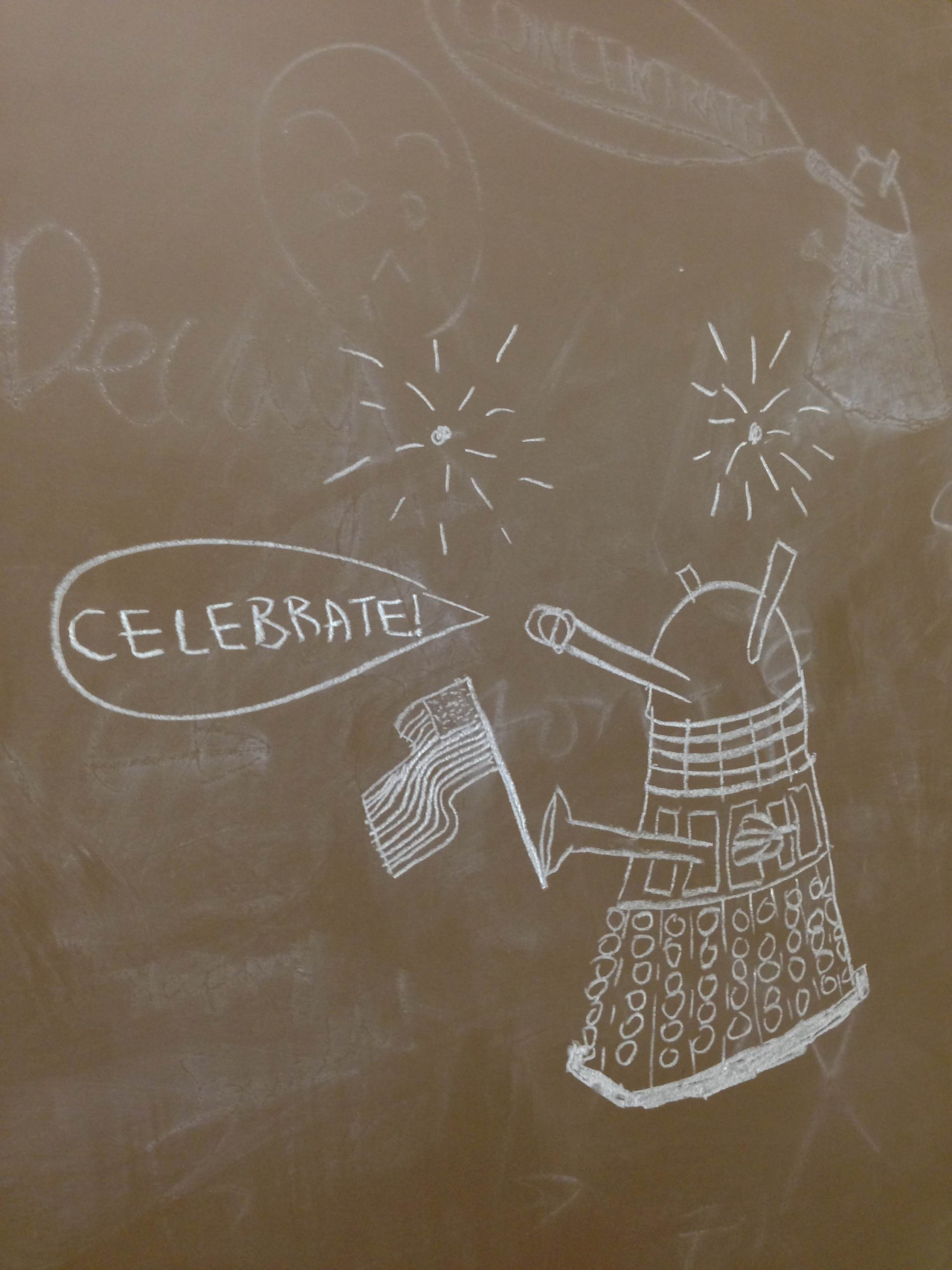
I turned the library chalkboard into a “Dalek-board”. Happy Fourth of July, American (and non-American) DW fans!


Tags:

#Doctor Who #art #fanart #puns #chalkboard drawing is a method of art I’ve actually used #allowing me to better appreciate the skill here #(I note there’s a faded picture of another Dalek saying ‘CONCENTRATE!’ in the background)

carlospalrner:

The hills are alive with the sound of illegal fireworks


Tags:

#anything that makes me laugh this much deserves a reblog #you can always tell when it’s a holiday weekend #or sometimes even when it’s *going* to be a holiday weekend #they’ll be out there three days in advance sometimes #Happy 4th of July to my American friends #try not to blow yourselves up #(the following category tag was added retroactively:) #home of the brave

bisexualzuko:

nonomella:

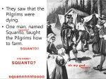
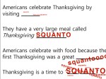
here are some excerpts from my thanksgiving lesson. once class just couldn’t let the whole squanto thing go. it was not a particularly productive lesson.

it’s six months from thanksgiving but this post never gets old
is squanto a chinese curse word or something


Tags:

#Thanksgiving #anything that makes me laugh this much deserves a reblog #may or may not have reblogged this before

bomburesmyspiritanimal:

chiltno:

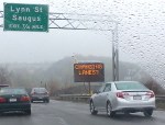
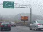
no one is more amused by massachusetts accents than people from massachusetts

In case anyone thinks that this is a joke or a ‘shop or something, this sign was put up in multiple places throughout Massachusetts. People still didn’t use their blinkers but they did chuckle as they flipped the bird and cut across 4 lanes to exit.


Tags:

#ah Massachusetts #my home away from home #(don’t forget the part where they drive in the breakdown lane)

Which English do you speak?

{{Title link: http://www.gameswithwords.org/WhichEnglish/ }}

profuseponderings:

Take this test, guys! It determines what dialect you speak (if your native language is English) and which country you are from (if English isn’t your first language!). 

It is an algorithm which maps out the differences in English grammar around the world. 


theheroheart:

Our top three guesses for your English dialect:
1. American (Standard)
2. Canadian
3. Singaporean

Our top three guesses for your native (first) language:
1. English
2. Russian
3. Dutch

Interestingly, I’m Norwegian, I always use British spellings and words, but standard American is probably what’s affected me most.


willowrosenberq:

Our top three guesses for your English dialect:
1. South African
2. Australian
3. English (UK)

Our top three guesses for your native (first) language:
1. English
2. Finnish
3. Russian

…HUH. Wasn’t expecting that at all.


laangol:

Cool!!!

Our top three guesses for your English dialect:
1. English (UK)
2. Singaporean
3. Australian

Our top three guesses for your native (first) language:
1. Italian
2. Finnish
3. Spanish


littleleofitz:

Haahaa this is awesome.

top guesses for your English dialect:

  1. Scottish (UK)
  2. Irish (Southern)
  3. Australian

Top guesses for your native (first language) a complete fail lol

  1. Portuguese
  2. English
  3. Finnish


ftchocoholic:

Well, it was accurate for me xD. Although Finnish does seem like a rather random second guess for a native first language…

Our top three guesses for your English dialect:

1. English (UK)
2. Scottish (UK)
3. Irish (Southern) 

Our top three guesses for your native (first) language:

1. English
2. Finnish
3. Russian 


karalianne:

Our top three guesses for your English dialect:

  1. Canadian
  2. American (Standard)
  3. Australian

Our top three guesses for your native (first) language:

  1. English
  2. Dutch
  3. German

I’m Canadian, so that’s pretty good. I find the Australian bit funny. Not sure why Dutch and German? Maybe because where we lived for grades 6-12 has way more Dutch people than anywhere else I’ve lived and my French teachers in high school were Dutch and German…? No idea. My family is UK for the most part. Mom’s parents came to Canada, Dad’s family was here for generations but came from the UK originally.


youneedacat:

Our top three guesses for your English dialect:

1. New Zealand
2. Scottish (UK)
3. South African

 
Our top three guesses for your native (first) language: 

1. Russian
2. English
3. Spanish

Um… I’m from California, the only language my family spoke besides English was Swedish, and the dialects of English my family spoke were generally Southern (Okie/Arkie).  So no idea how that works.


slepaulica:

I think it works based partially on how many people with your dialect have contributed. If there haven’t been too many with your dialect it won’t know it and won’t guess it right. Also, I think it might be on a country-level, not a within-country level, because it doesn’t seem to be making guesses like “california english” but just “united states english” or “scottish english”.

It’s possible that some of the ways you talk in your dialect of English was influenced by immigrants from one place or another, or that the rules for speaking your dialect are similar to the rules for speaking some other type english.

also for the “ntaive language” part it seems to be making guesses based on major world languages that lots of people speak. Like guessing Finnish instead of Udmurt or guessing Russian instead of Sorbian. :)

Our top three guesses for your English dialect:
1. Scottish (UK)
2. Australian
3. Canadian

Our top three guesses for your native (first) language:
1. Russian
2. English
3. Spanish

Our top three guesses for your English dialect:
1. American (Standard)
2. Australian
3. Singaporean

Our top three guesses for your native (first) language:
1. English
2. German
3. Dutch

I wonder how you tell whether someone is speaking Singaporean English.

I forgot to mention this in their own comment box, but it would be nice if they told you how good a match it is. Like, German’s the second guess for my native tongue, but how distant a second?


Tags:

#language #meme

mapsbynik:

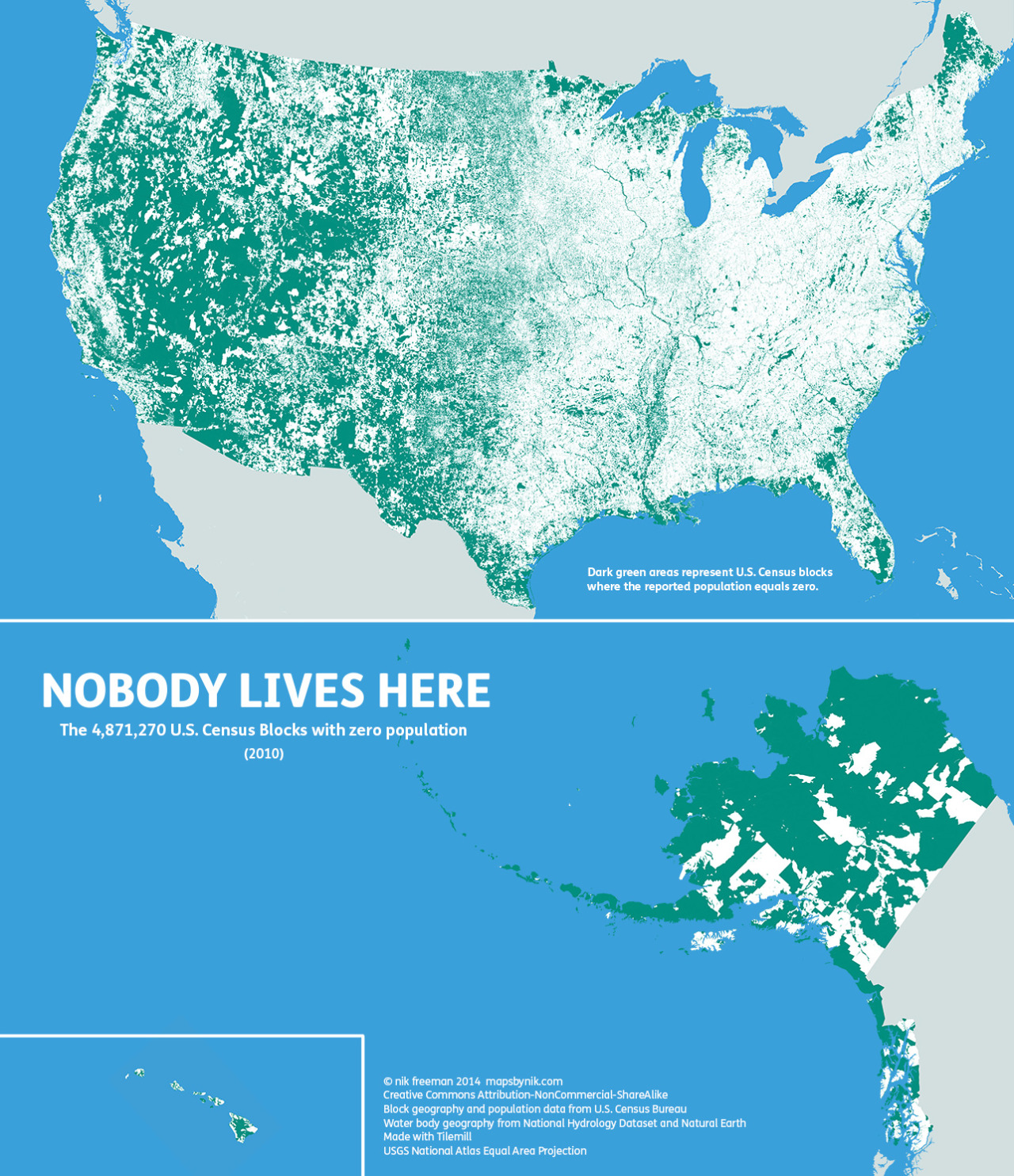
Nobody lives here: The nearly 5 million Census Blocks with zero population

A Block is the smallest area unit used by the U.S. Census Bureau for tabulating statistics. As of the 2010 census, the United States consists of 11,078,300 Census Blocks. Of them, 4,871,270 blocks totaling 4.61 million square kilometers were reported to have no population living inside them. Despite having a population of more than 310 million people, 47 percent of the USA remains unoccupied.

Green shading indicates unoccupied Census Blocks. A single inhabitant is enough to omit a block from shading

Map observations

The map tends to highlight two types of areas:

  • places where human habitation is physically restrictive or impossible, and
  • places where human habitation is prohibited by social or legal convention.

Water features such lakes, rivers, swamps and floodplains are revealed as places where it is hard for people to live. In addition, the mountains and deserts of the West, with their hostility to human survival, remain largely void of permanent population.

Of the places where settlement is prohibited, the most apparent are wilderness protection and recreational areas (such as national and state parks) and military bases. At the national and regional scales, these places appear as large green tracts surrounded by otherwise populated countryside.

At the local level, city and county parks emerge in contrast to their developed urban and suburban surroundings. At this scale, even major roads such as highways and interstates stretch like ribbons across the landscape.

Perhaps the two most notable anomalies on the map occur in Maine and the Dakotas. Northern Maine is conspicuously uninhabited. Despite being one of the earliest regions in North America to be settled by Europeans, the population there remains so low that large portions of the state’s interior have yet to be politically organized.

In the Dakotas, the border between North and South appears to be unexpectedly stark. Geographic phenomena typically do not respect artificial human boundaries. Throughout the rest of the map, state lines are often difficult to distinguish. But in the Dakotas, northern South Dakota is quite distinct from southern North Dakota. This is especially surprising considering that the county-level population density on both sides of the border is about the same at less than 10 people per square mile.

Finally, the differences between the eastern and western halves of the contiguous 48 states are particularly stark to me. In the east, with its larger population, unpopulated places are more likely to stand out on the map. In the west, the opposite is true. There, population centers stand out against the wilderness.

::

Ultimately, I made this map to show a different side of the United States. Human geographers spend so much time thinking about where people are. I thought I might bring some new insight by showing where they are not, adding contrast and context to the typical displays of the country’s population geography.

I’m sure I’ve all but scratched the surface of insight available from examining this map. There’s a lot of data here. What trends and patterns do you see?

::

©mapsbynik 2014
Creative Commons Attribution-NonCommercial-ShareAlike
Block geography and population data from U.S. Census Bureau
Water body geography from National Hydrology Dataset and Natural Earth
Made with Tilemill
USGS National Atlas Equal Area Projection


Tags:

#maps #neat #(the following category tag was added retroactively:) #home of the brave